
Garmin
Out of stock
 New Launch
 Free shipping Over $99
Couldn't load pickup availability

Free, Fast, Doorstep Delight!

Effortless Delivery, Easy Returns

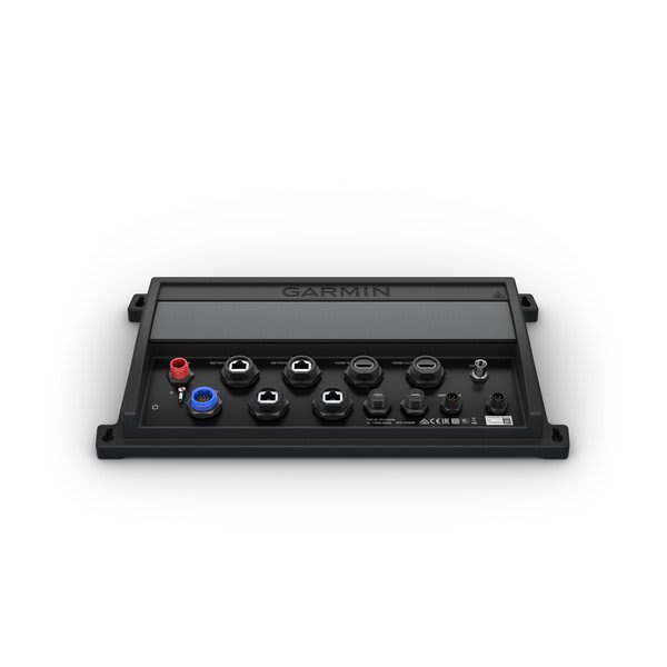
Give your vessel tremendous capabilities and features that are fully integrated across your entire marine system. This black box system is compatible with Garmin marine monitors or third-party touchscreen monitors (sold separately), allowing you to add to your current helm configuration or build a beautiful, new fully integrated glass helm.
The GPSMAP 8700 black box allows you to add and integrate multiple sonar technologies as well as autopilot, connected services, apps, engine data and multimedia at your helm. You can also automatically sync your personal preferences and user data for all networked chartplotters across multiple helms. Everything you need can conveniently be found at your fingertips — on any touchscreen. NMEA 2000® networking and the Garmin Marine Network allow you to easily build your full marine electronics suite — from radar and autopilots to cameras, instruments and forward-looking sonar — controlled from your chartplotter and shared across multiple screens. In addition, our exclusive OneHelm™ system coordinates many third-party manufactured onboard marine products to bring full control of systems — such as digital switching, lighting, stabilization and more — to your touchscreen monitor. Connect to different kinds of engines — including select Mercury and Yamaha® models — to see RPMs, fuel flow, temperature, trim and other important information on your display. You may need additional hardware, so be sure to check with your engine manufacturer.
The GPSMAP 8700 black box can pair with our GPS 19x external 10 Hz GPS and GLONASS receiver (sold separately) to update your position and heading 10 times per second. It displays a more fluid vessel movement and dramatically improves your ability to accurately mark and navigate to 5,000 waypoints.
The Garmin Card Reader (sold separately) provides convenient remote mounting and a single access point for 2 SD™ card slots for mapping. You can add multiple card readers for additional access points. A water-resistant magnetic door allows card reader to be mounted horizontally or vertically.
Upgrade your maps with the most detailed, clear and concise charts and maps. Just add accessory map purchases such as BlueChart g3 and BlueChart g3 Vision coastal cartography and LakeVü g3 and LakeVü g3 Ultra inland mapping featuring Navionics data and Auto Guidance¹ technology. Auto Guidance technology uses your specified depth and overhead clearance to easily calculate routes and see a suggested path to follow. It’s also compatible with Quickdraw Contours software so you can instantly create personalized fishing maps on-screen with 1’ contours as you fish.
¹Auto Guidance is for planning purposes only and does not replace safe navigation operations
| Dimensions | 15.1" x 7.8" x 1.9" (38.3 x 19.8 x 4.7 cm) |
| Weight | 3.06 lbs (1.39 kg) |
| Water rating | IPX7 |
| Display Type / Size | None (External display required) |
| Display resolution | 1024 x 768, 1280 x 1024, 1920 x 1080, 1920 x 1200 |
| Accepts Data Cards | 2 SD™ cards (Garmin Card Reader required) |
| Waypoints | 5,000 |
| Navigation Routes | 100 |
| NMEA 2000 / NMEA 0183 Compatible | ✓ |
| Smart Mode Compatible | ✓ |
| AIS / DSC Support | ✓ |
| Supports Fusion-Link™ compatible radios | ✓ |
| GSD / GCV Black Box Sonar Support | ✓ |
| ActiveCaptain® compatible | ✓ |
| GRID (Garmin Remote Input Device) compatible | ✓ |
| Sailing Features | ✓ |
| NMEA 0183 Input (Rx) Ports | 4 |
| Video input ports | 1 - BNC composite, 1 - HDMI |
| Video output ports | 1 - HDMI |
| Garmin Marine Network Ports | 4 |
| USB | 2 micro |
Add your content here for Tab 1.22
Add your content here for Tab 1.
[title]
[message]Love it? Add to your wishlist
Your favorites, all in one place. Shop quickly and easily with the wishlist feature!

