
Garmin
 New Launch
 Free shipping Over $99
 Sold in last hours
Couldn't load pickup availability

Free, Fast, Doorstep Delight!

Effortless Delivery, Easy Returns


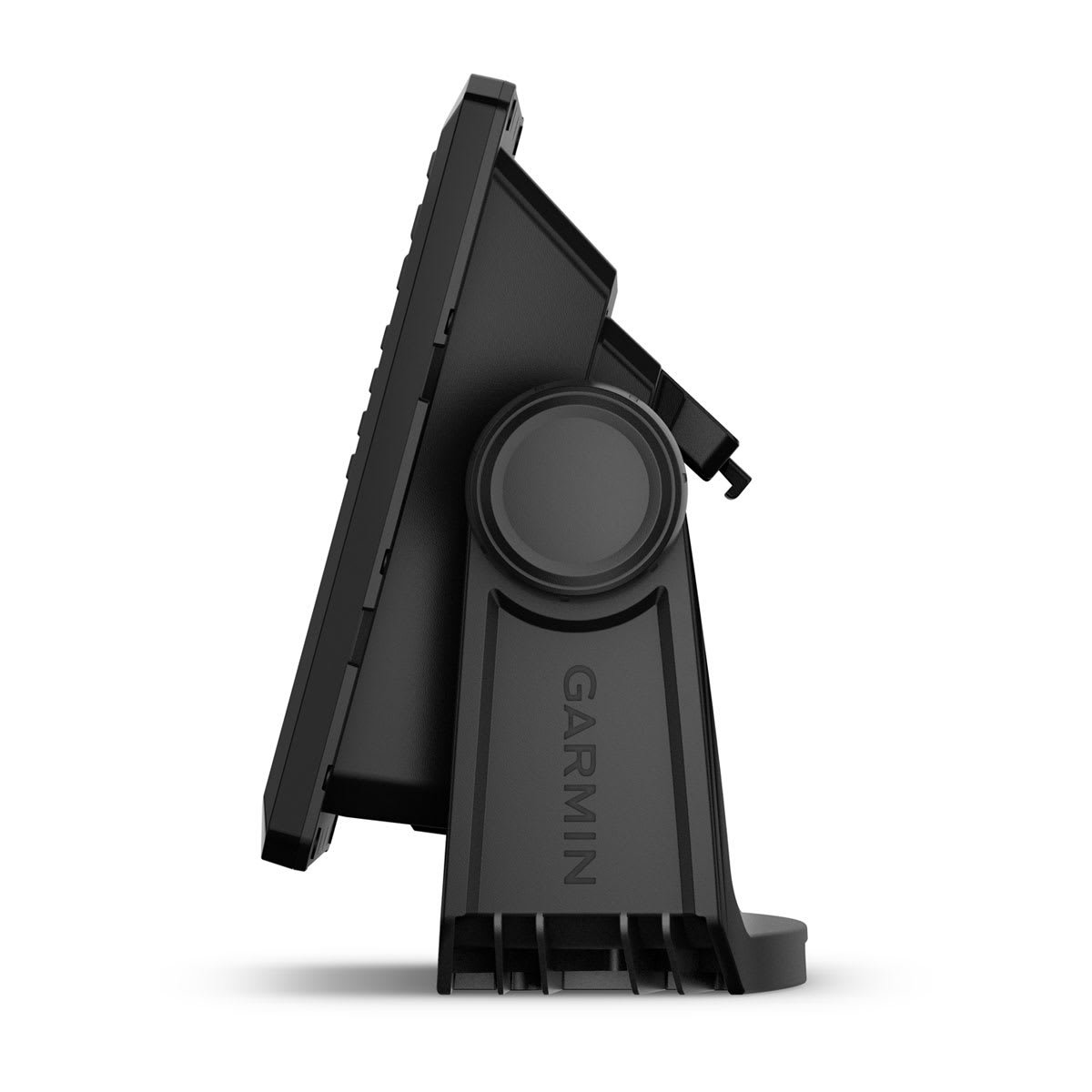
They say locals know best. But anyone who says that hasn’t fished with the ECHOMAP UHD2 5” and 7” chartplotters with clear, crisp sonar and mapping.
The bright 5” or 7” keyed display is made for convenience.
Get double the views1 with Garmin CHIRP traditional and ClearVü scanning sonars.
What’s under the water looks even better with high-contrast vivid color palettes.
Wi-Fi® connectivity2 between compatible chartplotters makes it easy to share info.
Enjoy No. 1 in mapping3 with Garmin Navionics+™ inland and coastal content.
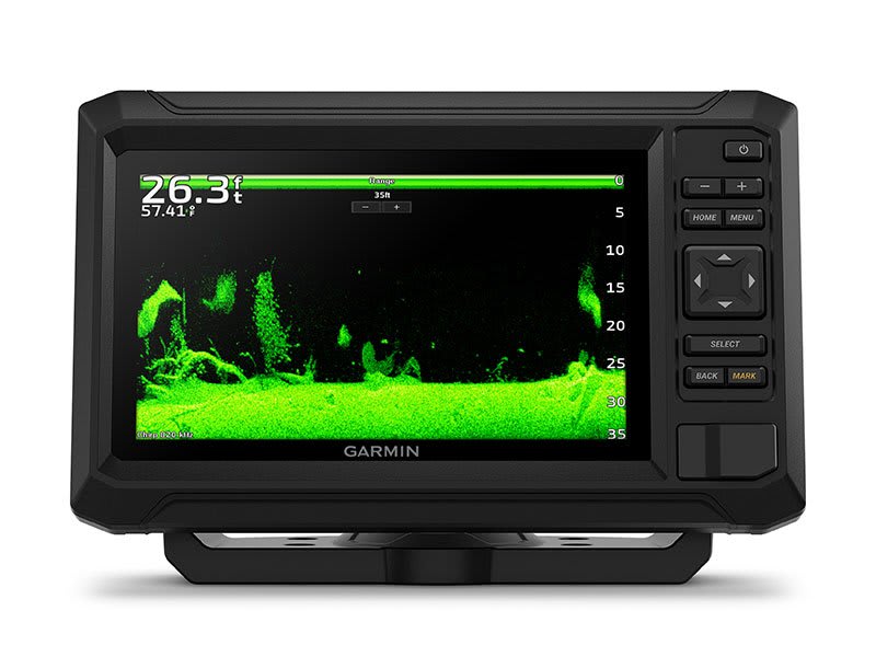
With crisp, clear traditional sonar and brilliant ClearVü sonar, the fish will have nowhere to hide.
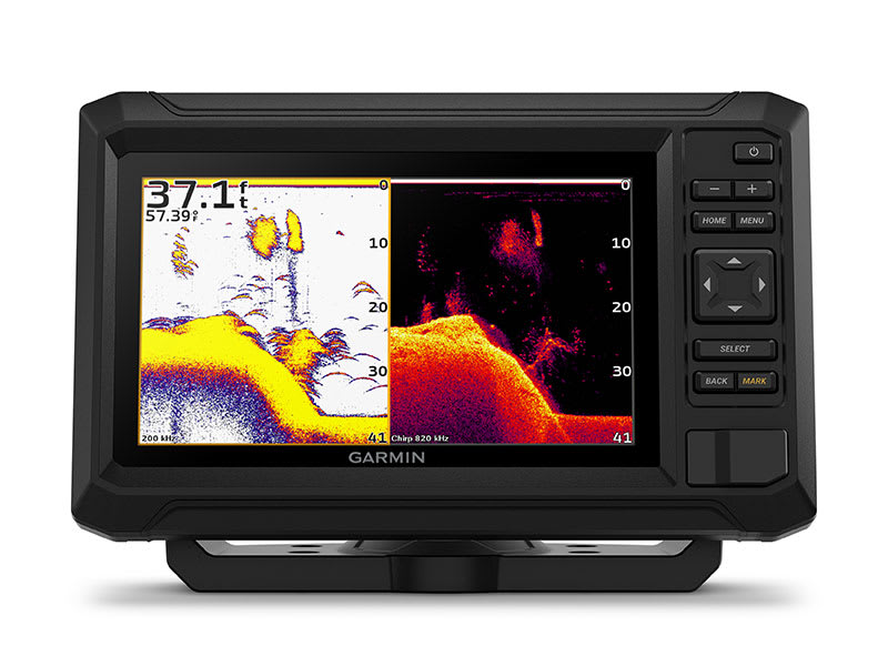
High-contrast vivid scanning sonar color palettes make it easier than ever to distinguish targets and structure.
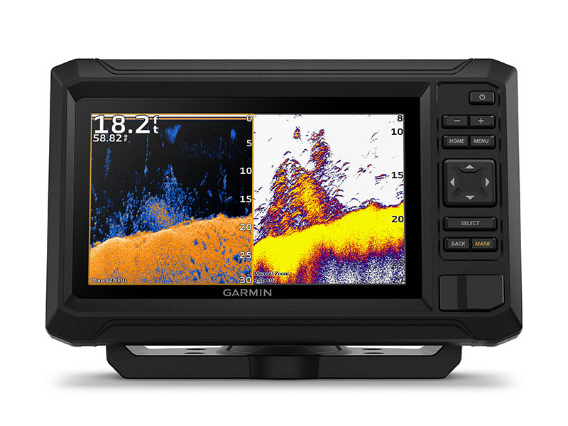
Your ECHOMAP UHD2 device supports a variety of Garmin transducers for two types of sonar: Garmin traditional and ClearVü scanning sonars.
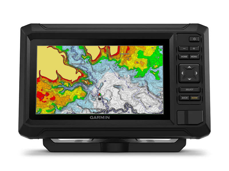
Know the waters you're in as if you grew up fishing them by using built-in Garmin Navionics+ coastal or inland mapping which includes a 1-year subscription for downloadable daily updates and more.
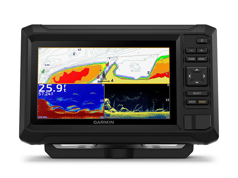
If you have another compatible ECHOMAP UHD2 chartplotter on your boat, the 5” and 7” models can wirelessly share information — such as sonar, waypoints and routes — with them.
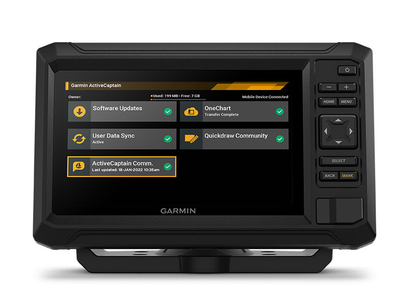
Built-in Wi-Fi connectivity pairs with the free all-in-one mobile app for access to the OneChart™ feature, software updates, Garmin Quickdraw™ Community data and more2.
| General | |
| Dimension | 10.4" x 6.5" x 3.2" (26.4 x 16.6 x 8.0 cm) |
| Weight | 2.9 lbs (1.3 kg) |
| Water rating | IPX7 |
| Touchscreen | ✓ |
| Display Type | WSVGA, TN |
| Display Size | 7.8" x 4.5", 9.0" (19.8 x 11.5 cm, 22.9 cm) |
| Display resolution | 1024 x 600 pixels |
| Mounting Options | Bail or flush |
| Input | Touchscreen with Keyed Assist |
| Maps & Memory | |
| Accepts Data Cards | 1 microSD™ card; 32 GB maximum size |
| Waypoints | 5,000 |
| Track points | 50,000 |
| Tracks | 50 saved tracks |
| Navigation Routes | 100 |
| Sensors | |
| GPS | ✓ |
| GLONASS | ✓ |
| Galileo | ✓ |
| BeiDou | ✓ |
| Has built-in receiver | ✓ |
| Receiver | 10 Hz |
| NMEA 2000 Compatible | ✓ |
| Supports WAAS | ✓ |
| Supports multi-band, multi-constellation GPS | ✓ |
| Built-in Maps | |
| Built-in Auto Guidance+ | yes (downloadable via ActiveCaptain app) |
| Garmin Navionics+ Inland & Coastal | yes (see Additional) |
| Garmin Navionics+ (Coastal) | yes (see Additional) |
| Garmin Navionics+ (Inland) | yes (see Additional) |
| Tide tables | yes (see Additional) |
| Optional Map Support | |
| BlueChart g3 | ✓ |
| BlueChart g3 Vision | ✓ |
| LakeVü g3 | ✓ |
| LakeVü g3 Ultra | ✓ |
| Garmin Navionics+™ | ✓ |
| Garmin Navionics Vision+™ | ✓ |
| TOPO 100K | ✓ |
| Standard Mapping | ✓ |
| Garmin Quickdraw Contours | ✓ |
| Chartplotter Features | |
| AIS | ✓ |
| DSC | ✓ |
| Supports Fusion-Link™ compatible radios | ✓ |
| ActiveCaptain® compatible | ✓ |
| Sailing Features | ✓ |
| Electrical Features | |
| Power Input | 9 to 18 Vdc |
| Typical current draw at 12 Vdc | 1.72 A |
| Maximum current draw at 12 Vdc | 3.5 A |
| Maximum power usage at 10 Vdc | 20.7 W |
| Sonar Features | |
| Displays sonar | ✓ |
| Power output | 500 W |
| Traditional sonar (dual frequency/beam) | Built-in (single channel CHIRP, 50/77/83/200 kHz, L, M, H CHIRP) |
| ClearVü | Built-in 260/455/800/1000/1200 kHz |
| SideVü | Built-in 260/455/800/1000/1200 kHz |
| Panoptix™ sonar | ✓ |
| LiveScope | ✓ |
| Connections | |
| NMEA 2000® ports | ✓ |
| Garmin Marine Network Ports | 1 |
| 12-pin transducer ports | 1 |
| Bluetooth® pairing | ✓ |
| ANT® (Connectivity) | ✓ |
| Garmin Wi-Fi network (local connection) | ✓ |
| Additional | |
| Garmin Navionics+ (inland and coastal) | 95sv Canada, Australia and New Zealand |
| Garmin Navionics+ (coastal) | 94sv U.S. coastal, 95sv UK/Ireland |
| Garmin Navionics+ (inland) | 93sv U.S. lakes |
| Tide tables | 93sv, 94sv, 95sv |
Add your content here for Tab 1.22
Add your content here for Tab 1.
[title]
[message]Love it? Add to your wishlist
Your favorites, all in one place. Shop quickly and easily with the wishlist feature!


