
Garmin
 New Launch
 Free shipping Over $99
 Sold in last hours
Couldn't load pickup availability

Free, Fast, Doorstep Delight!

Effortless Delivery, Easy Returns


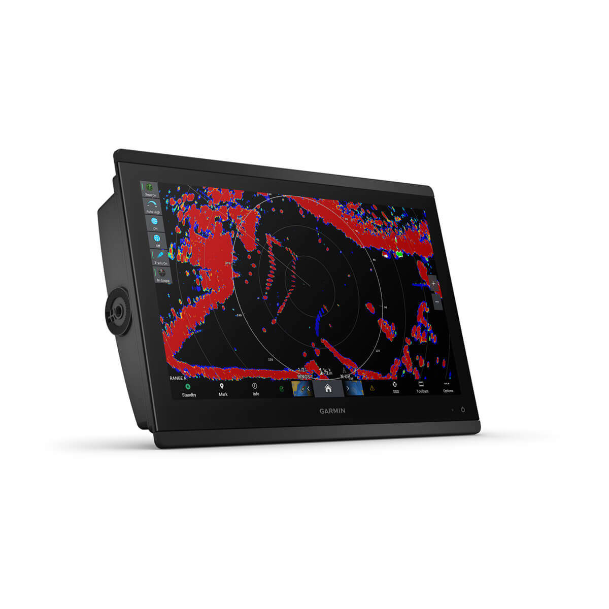
The easy-to-use, easy-to-install chartplotter/sonar combo delivers MFD performance in a combo-size package.

Get wider viewing angles and superior clarity on the touchscreen with a full HD in-plane switching (IPS) display.

Navigate confidently with built-in Garmin Navionics+™ inland and coastal mapping1.

Easily build your marine system using the best of network connectivity.

See below and around your boat with built-in sonar capabilities (transducers sold separately).

From ANT® technology to Wi-Fi® networking, there are countless ways to connect to your system.

With SmartMode™ station controls, everything is designed to give you quick, one-touch access to the information you need.
Available in sizes from 10” to 24”, this display offers wider viewing angles, superior clarity and sunlight readability, even with polarized sunglasses.
You can install multiple displays, either flat mounted edge-to-edge for a sleek glass helm look or mounted flush — creating a stunning helm.
The optional, easy-to-use GRID 20 remote input device provides intuitive remote access and control of your entire Garmin marine system.
Get built-in support for 1-kW Dual-Channel CHIRP traditional sonar for superior target separation and ClearVü and SideVü scanning sonars to see up to 1,000’ below and around your boat at 260 kHz (requires transducer, sold separately).
Pair your chartplotter with Garmin live sonar options (transducer sold separately) to see all around your boat in real time.
View laylines, race start line guidance, enhanced wind rose, heading and course-over-ground lines, true wind data fields and tide/current/time slider, wind angle, set and drift, wind speed, polars and more.
Experience unparalleled coverage and detail with built-in Garmin Navionics+™ integrated coastal and inland mapping that includes Auto Guidance+™ technology2 and a 1-year subscription for downloadable daily updates and more on select chartplotters.
Bring a fresh new look and feel to your chartplotter with optional upgrade to Garmin Navionics Vision+™ premium chart subscription, featuring downloadable high-resolution relief shading, satellite imagery, sonar imagery and more.
Use the polar table to see key data, including how fast you should go at a certain wind angle and speed — so you know whether you need to adjust sail trim.
If you have multiple compatible Garmin devices on your boat, you can share information — such as maps, user data, radar and IP cameras — among them.
Connect to autopilots, digital switching, weather, FUSION-Link™ audio system, media, VHF, AIS and more from one screen.
Built-in Wi-Fi® connectivity pairs with the free all-in-one mobile app for access to the OneChart™ feature, smart notifications3 , software updates, Helm, Garmin Quickdraw™ Community data and more.
Connect with some of your favorite devices, such as quatix® marine watches, gWind™ Wireless 2 transducers, GNX™ Wind marine instruments and wireless remote controls.
This feature brings together all the operations and capabilities of third-party devices, such as EmpirBus™ digital switching, on one screen.
Get quick, one-touch access to the information you need to ease high-stress situations such as docking. You can incorporate networked sonar, radar, cameras, media and more.
By networking select Garmin chartplotters with a Force® trolling motor and your compatible Power-Pole shallow water anchoring system, you can access advanced boat control features5 from your plotter, including smart anchor auto-deployment, smart anchor jog, auto stow, anchor drag detection and auto guidance6 end-of-route anchoring. Spend more time fishing, less time positioning.
Your CHARGE Marine Power Manager from Power-Pole integrates with compatible Garmin chartplotters to help keep your battery power going longer and stronger on the water. You’re able to charge batteries on the run, monitor power use, select where power is allocated, control emergency starts and even transfer power between battery banks — all from your chartplotter display.
Pair your inReach satellite communicator4 to your chartplotter, and type custom messages using your MFD’s on-screen keyboard. Access your contact list or enter an email, inReach address or phone number. You can also group messages by conversation for a texting-like experience.
| Feature | Specification |
| General | |
| Dimension | 15.1" x 10.3" x 3" (38.5 cm x 26.3 cm x 7.6 cm) |
| Weight | 9.6 lbs (4.4 kg) |
| Water rating | IPX7 |
| Touchscreen | |
| Display Type | FHD, IPS |
| Display Size | 13.6" x 7.7"; 15.6" diagonal, 34.5 cm x 19.5 cm; 39.7 cm diagonal |
| Display resolution | 1920 x 1080 pixels |
| Mounting Options | Flat and flush, bail with optional accessory (Garmin does not offer any hardware or accessories for a flat-mount installation. Professional tools and knowledge is required.) |
| Input | Touchscreen |
| Maps & Memory | |
| Accepts Data Cards | 2 microSD cards |
| Waypoints | 5000 |
| Track points | 50,000 |
| Tracks | 50 saved tracks |
| Navigation Routes | 100 |
| Sensors | |
| GPS | Yes |
| GLONASS | Yes |
| Galileo | Yes |
| Has built-in receiver | Yes |
| Receiver | 10 Hz |
| NMEA 2000 Compatible | Yes |
| NMEA 0183 Compatible | Yes |
| Supports WAAS | Yes |
| Built-in Maps | |
| Built-in Auto Guidance+ | Yes |
| Garmin Navionics+ Inland & Coastal | Yes |
| Tide tables | Yes |
| Optional Map Support | |
| Garmin Navionics+™ | Yes |
| Garmin Navionics Vision+™ | Yes |
| TOPO 100K | Yes |
| Standard Mapping | Yes |
| Garmin Quickdraw Contours | Yes |
| Raster chart support | Yes |
| Chartplotter Features | |
| Smart Mode Compatible | Yes |
| AIS | Yes |
| DSC | Yes |
| Supports Fusion-Link™ compatible radios | Yes |
| GSD Black Box Sonar Support | Yes |
| GCV Black Box Sonar Support | Yes |
| ActiveCaptain® compatible | Yes |
| GRID (Garmin Remote Input Device) compatible | Yes |
| Wireless Remote Compatible | Yes |
| Sailing Features | Yes |
| Spoken audio alerts | Yes |
| OneHelm support | Yes |
| Electrical Features | |
| Power Input | 10 to 32 Vdc |
| Typical current draw at 12 Vdc | 1.3 A |
| Maximum current draw at 12 Vdc | 6.0 A |
| Maximum power usage at 10 Vdc | 52.1W |
| Sonar Features | |
| Displays sonar | Yes |
| Traditional sonar (dual frequency/beam) | Yes (with GCV™ black box, sold separately) |
| ClearVü | Yes (with GCV™ black box, sold separately) |
| SideVü | Yes (with compatible black box sonar) |
| Panoptix™ sonar | Yes |
| LiveScope | Yes |
| Connections | |
| NMEA 2000® ports | 1 |
| NMEA 0183 Input (Rx) Ports | 1 |
| NMEA 0183 output (Tx) ports | 1 |
| Video input ports | 1 (BNC composite); 1 HDMI (HDCP compliant) |
| Video output ports | 1 HDMI |
| J1939 ports | 1 |
| Garmin Marine Network Ports | 2 |
| USB ports | Yes |
| BNC external GPS antenna port | Yes |
| BLUETOOTH® pairing | Yes |
| ANT® (Connectivity) | Yes |
| Garmin Wi-Fi network (local connection) | Yes |
Add your content here for Tab 1.22
Add your content here for Tab 1.
[title]
[message]Love it? Add to your wishlist
Your favorites, all in one place. Shop quickly and easily with the wishlist feature!


